ArcLogistics Project
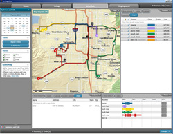 |
Using Arclogistics 3 projects were created to help field staff. These were designeed to help the Inspectors map out their assignments for the day.
The first project was for the Code Enforcement officers. The program was installed and accounts created on staff computers. By working with the Esri representative and management, maps of the areas the inspectors work in were created. This project consisted of 6 drivers and 6 routs divided up into 5 zones. The second project, for building inspectors, also had 6 drivers and 6 routs but only 4 zoned. This project had 46 inspection types that needed to be covered, but not all inspectors could cover all types. The Final project was created for the Business License Inspectors. These people ran custom Crystal reports that pulled inspection information out of a database then mapped and created routs. |
Business Licenses
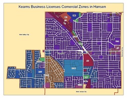 |
I use ESRI's ArcMap software in conjunction with our Oracle Database to meet end user requirements. Business Licenses, Building Permits and Case Files are imported geocodded. The Data is analyzed depending on the requirement, such as a certain type of business in a particular area, or distance to other businesses.
|
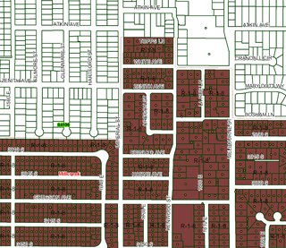
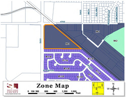
Editing Zone File
|
Working with the G.I.S. employee I help edit the active zoning layer used by Salt Lake County Planning and Development office.
|
Incorporation Study for Millcreek Township
|
Another project that required a lot of time was delivering information for the MILLCREEK Incorporation feasibility study. Several reports were created to pull information out of the Oracle database. The information requested was related to Building permits, Planning files, Business Licenses, and Case files. These reports were changed several times reflecting the changes in the requested information. This information was them imported in to the G.I.S. system and mapped. The relevant information in the desired areas was then selected and calculations performed. This was done for the years requested.
|
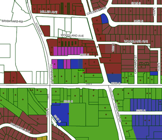
Infill Housing Project
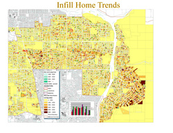 |
This map was created to analyze Assessors office data on Living area sqr footage, Planning and development services office data on Building permit type, and Surveyor’s office data on lot size.
|
Public Meetings
  |
Planning/Development Services public presentations: These presentations include GIS zoning maps and aerial photography.
Planning/Development Services public presentations: These presentations include GIS zoning maps and aerial photography. |
Write-ups
|
| ||||
